
Tuzluca and Harmandöven open the province’s history of resources and movement. One reveals salt and extraction; the other the accommodation needs of historic travellers.
An AI-assisted synthesis of the sources below, with Atlas planning suggestions. This is not a first-hand visit report. Admission, transport and access conditions must be checked with operators before travel.
In this guide
Visiting and production at Tuzluca
The galleries are not simply a naturally formed cave scene: salt extraction is part of their history. Distinguish visitor space from operating areas. Services advertised as salt therapy are not presented here as a guarantee of medical benefit.
The enclosed arrangement at Harmandöven
Also called Ejder Caravanserai, the building is notable for its courtyard-free plan. Its relationship with the historic Batumi–Tabriz route helps explain its position. The absence of an inscription requires care with claims about patronage and precise dating.
Plan district journeys correctly
Ask the operator about current visiting and participation conditions at Tuzluca. Verify open areas and transport for the caravanserai separately. Being in one province does not place both sites within walking distance. Their strongest connection is economic history, not geographical proximity.
Reading Iğdır between the plain and the mountain
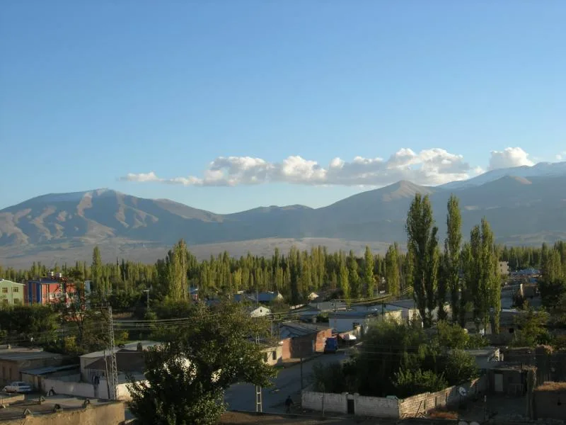
Treating Iğdır simply as a viewpoint for Mount Ararat misses the province's defining contrast. The Sürmeli Plain beside the Aras lies far below the surrounding highlands. The local microclimate described by the regional development agency helps explain why orchards and vegetable cultivation matter here. Irrigation, gardens and settled land belong to the foreground; volcanic slopes dominate the horizon. Farming is not incidental scenery beneath a famous mountain, but a story of water, work and seasonal production in its own right.
Iğdır became a province separate from Kars in 1992. Its central district, Tuzluca, Karakoyunlu and Aralık make different journeys rather than a single compact sightseeing circuit. Tuzluca lies westward, while Aralık takes a visitor toward the province's eastern end. Neighbouring Armenia, Iran and Azerbaijan's Nakhchivan Autonomous Republic does not mean every frontier is open to visitors. Distinguish geographical proximity from crossing permission, and use the city as a practical base for meals, accommodation and separately planned district excursions.
Harmandöven: how a caravan route became architecture
The Ejder Caravanserai at Harmandöven belongs to the medieval trading landscape associated with a branch of the Batumi–Tabriz route. The Ministry's Culture Portal notes that it lacks a foundation inscription and is attributed to Şerafettin Ejder Bey. Official promotional accounts give differing century dates, so a precise founding year would imply evidence that these accounts do not supply. Start instead with what makes the building informative: its enclosed arrangement and function within the infrastructure that sheltered travellers and their goods.
Look beyond the entrance photograph to the relationship between the exterior mass and the interior spaces. Its courtyard-free plan offers a useful contrast to other caravanserais encountered across Anatolia. Restored surfaces do not establish that every stone has remained untouched since the Middle Ages; nor does restoration erase the building's historical interest. This is a rural excursion rather than a stop within a city walk. Arrange return transport in advance so the visit can be about understanding the structure rather than watching the clock.
Tuzluca: salt galleries and a landscape of colour
Tuzluca's salt caves are not simply a natural hollow: their galleries also record the extraction of rock salt. The Culture Portal places the salt layers within a much older geological history and records the opening of a tourism centre in 2021. A visitor can read crystalline surfaces alongside the marks of human work. Access to a visitor area does not imply permission to enter all working sections, and the language of salt therapy in tourism promotion should not be mistaken for established medical advice or a promise of treatment.
Elsewhere in the same district, the Rainbow Hills offer an outdoor counterpart. Red, brown, yellow and grey tones make contrasting surface materials visible. Light and weather affect how those bands appear, so heavily saturated photographs are not a guarantee of what every visit will look like. A gallery visit and a walk on exposed ground also call for different footwear and preparation. Reading Tuzluca through production, geology and landscape produces a richer excursion than reducing it to one cave attraction.
The Aras: a place of field science, not only scenery
Near Yukarı Çıyrıklı in Tuzluca, the Aras Bird Research and Education Center gives Iğdır an important scientific story. Migration research has continued here since autumn 2006. Ringing is not decoration: within licensed work by specialists, it gives an individual bird an identity that can connect a local encounter with later records elsewhere. Willows, reedbeds, small water bodies and neighbouring farmland should be understood as linked habitats that support feeding, resting and breeding, rather than as an empty margin beside the river.
Visitors should observe this work rather than imitate it. Contact the centre before arrival, follow its instructions and do not touch nets, birds or research equipment. Bulakbaşı and the Karasu surroundings offer further ways to understand water-dependent landscapes, but these are not all parts of the research station's premises. Species and visibility change with the season. Binoculars, patience and an undisturbed habitat matter more than playing bird calls or forcing a close encounter for a photograph. The public research film provides an introduction to the methods, not an invitation to handle wildlife.
Karakoyunlu's carved memory and the living table
The ram-shaped gravestones promoted around Karakoyunlu and Yaycı are striking examples of a sculptural funerary tradition. Shape, markings and archaeological context need to be considered together; it is misleading to assign every example to an identical date, individual or community solely from its form. Historical attributions in official tourism material should be read alongside inscriptions and conservation information at the site. A cemetery also remains a place of memory for people with living relatives, not just a convenient background for photographs.
Food offers a different way into the province's borderland culture. Connections with Azerbaijani and Iranian cooking are visible in dishes such as lamb-and-chickpea bozbaş, katlet and lepeli ekşili pilav. These are distinct preparations rather than interchangeable labels for meat and rice. Şalak apricots connect the table to the orchards of the plain. A shared dish name does not make every household recipe identical: ask about the season, family practice and a shop's own production. Buying local produce can create a more meaningful relationship with this working culture than simply looking at it.
Choose the visit that fits your question
Resource history
Read the galleries through their extraction past.
Route history
See the inn within an accommodation network.
Verification
Check visiting conditions for each destination.
Visual exploration before you travel
Bird research and ringing on the Aras River — part 1
A public film linked by KuzeyDoğa's research library and published on the researcher's channel, explaining work at the Aras station. It is scientific context, not a current opening-hours notice or an overview of every district.
Practical questions before your visit
Does a visit to Iğdır require climbing Mount Ararat?
No. The plain, Harmandöven, Tuzluca and the Aras offer contrasting experiences without mountaineering. A summit expedition is different from a roadside view: it requires appropriate permissions, professional arrangements, high-altitude preparation and current conditions.
Why is the caravanserai not given a definite founding century?
The official account notes the absence of a foundation inscription, and promotional sources differ in their dating. Explaining the building as part of a medieval trading landscape is more accurate than converting an uncertain attribution into a precise year. Check the site's archaeological and conservation interpretation for further detail.
Can I approach birds at the research station?
Arrange a visit with the centre and follow the researchers' instructions. Capture and ringing are not visitor activities. Observing without disturbing nests, nets or sensitive habitats supports both wildlife protection and the continuity of scientific work.
Sources and scope of this guide
These primary sources support the historical and heritage background. Comparisons and suggested ways to organise a visit are Atlas editorial analysis, not instructions from the source institutions.
- Kültür Portalı · TUZLUCA TUZ MAĞARALARI ↗
- Kültür Portalı · HARMANDÖVEN (EJDER) KERVANSARAYI ↗
- SERKA — Iğdır coğrafyası ↗
- SERKA — Iğdır hakkında ve ilçeleri ↗
- SERKA — Iğdır gezilecek yerler ↗
- KuzeyDoğa — Aras Bird Research and Education Center ↗
- Iğdır Üniversitesi Kuş Bilimi Merkezi — Aras istasyonu ↗
- GoTürkiye — Iğdır lezzetleri ↗
- KuzeyDoğa — kamuya açık araştırma filmleri kütüphanesi ↗