Independent Türkiye discovery and reference guide

Cumhuriyet Atlas

Cumhuriyet Atlas · National directory

81 provinces. Seven regions. Endless ways to explore.

From ancient cities to highland landscapes, museums to local food: explore Türkiye through province guides, travel routes and World Heritage.

Provinces
81
Official place records
941
Verified heritage places
22
Sourced place photographs
7

Explore Türkiye, one place at a time

7 regions. 81 provinces. Your journey.

Hover over a region to discover its provinces. Explore their boundaries, open a photographic preview and continue to an in-depth guide.

On a computer, hover over a province and click to open its guide. On a touch screen, select a province, then use “Open province guide”.

Adana · 01 Adıyaman · 02 Afyonkarahisar · 03 Ağrı · 04 Amasya · 05 Ankara · 06 Antalya · 07 Artvin · 08 Aydın · 09 Balıkesir · 10 Bilecik · 11 Bingöl · 12 Bitlis · 13 Bolu · 14 Burdur · 15 Bursa · 16 Çanakkale · 17 Çankırı · 18 Çorum · 19 Denizli · 20 Diyarbakır · 21 Edirne · 22 Elazığ · 23 Erzincan · 24 Erzurum · 25 Eskişehir · 26 Gaziantep · 27 Giresun · 28 Gümüşhane · 29 Hakkari · 30 Hatay · 31 Isparta · 32 Mersin · 33 İstanbul · 34 İzmir · 35 Kars · 36 Kastamonu · 37 Kayseri · 38 Kırklareli · 39 Kırşehir · 40 Kocaeli · 41 Konya · 42 Kütahya · 43 Malatya · 44 Manisa · 45 Kahramanmaraş · 46 Mardin · 47 Muğla · 48 Muş · 49 Nevşehir · 50 Niğde · 51 Ordu · 52 Rize · 53 Sakarya · 54 Samsun · 55 Siirt · 56 Sinop · 57 Sivas · 58 Tekirdağ · 59 Tokat · 60 Trabzon · 61 Tunceli · 62 Şanlıurfa · 63 Uşak · 64 Van · 65 Yozgat · 66 Zonguldak · 67 Aksaray · 68 Bayburt · 69 Karaman · 70 Kırıkkale · 71 Batman · 72 Şırnak · 73 Bartın · 74 Ardahan · 75 Iğdır · 76 Yalova · 77 Karabük · 78 Kilis · 79 Osmaniye · 80 Düzce · 81

Use Tab to reach regions and provinces. Enter or Space selects a region; Enter on a province opens its guide. Escape closes the preview. Use the province selector or regional list for small boundaries.

Generalized province boundaries: Natural Earth. Colours and bold outlines show the Atlas’s whole-province regional groups, not precise geographical-region borders that cross provinces.

Map source and method

Natural Earth · public-domain vector data · 1:10 million · v5.1.0. An exploration map, not a survey or cadastral map.

Natural Earth · source data ↗ Data reuse terms ↗

81-province directory

Find by plate code, city or region

Explore history, districts, itineraries, transport, local food and visitor notes across all 81 provinces. Choose a city or search by plate code and region.

Marmara →

11

Aegean →

8

Mediterranean →

8

Central Anatolia →

13

Black Sea →

18

Eastern Anatolia →

14

Southeastern Anatolia →

9

Read a focused destination guide

Seven silent visual routes7 items · explore

Original motion Atlas

Seven silent visual routes

These short videos were assembled from AI-generated regional illustrations, not documentary footage. They contain no music, tracking code or third-party player; you stay in control and nothing autoplays.

Coasts and Western AnatoliaA silent visual route assembled from three original Atlas illustrations, from Marmara to the Mediterranean.10.5 seconds · Cumhuriyet Atlas / original generated visual sequence
From the Heartland to the EastA silent visual route assembled from two original Atlas illustrations of Central and Eastern Anatolia.7.2 seconds · Cumhuriyet Atlas / original generated visual sequence
From Highlands to MesopotamiaA silent visual route assembled from two original Atlas illustrations of the Black Sea and Southeastern Anatolia.7.2 seconds · Cumhuriyet Atlas / original generated visual sequence
From the Straits to the AegeanA silent visual route assembled from two original Atlas illustrations of Marmara and the Aegean.7 seconds · Cumhuriyet Atlas / original generated visual sequence
From the Turquoise Coast to the HeartlandA silent visual route assembled from two original Atlas illustrations of the Mediterranean and Central Anatolia.7 seconds · Cumhuriyet Atlas / original generated visual sequence
From Green Highlands to the EastA silent visual route assembled from two original Atlas illustrations of the Black Sea and Eastern Anatolia.7 seconds · Cumhuriyet Atlas / original generated visual sequence
From Mesopotamia to the HeartlandA silent visual route assembled from two original Atlas illustrations of Southeastern and Central Anatolia.7 seconds · Cumhuriyet Atlas / original generated visual sequence
22 properties on the UNESCO World Heritage List22 items · explore

World Heritage

22 properties on the UNESCO World Heritage List

Discover Anatolia’s cities, sacred buildings and cultural landscapes through genuine photographs. Continue to a detailed site dossier or province guide; each card also provides its UNESCO record and photographic rights.

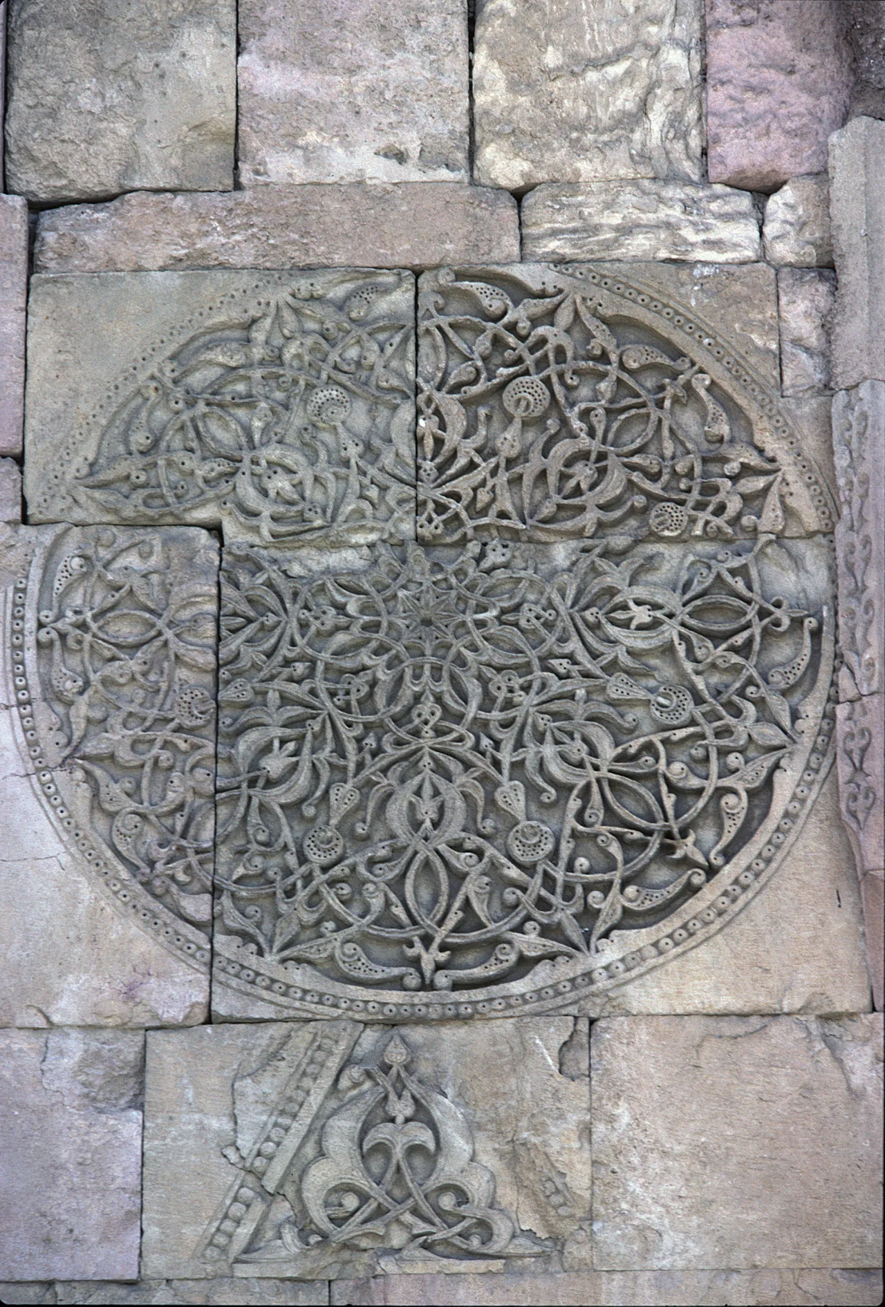
A relief detail of Divriği's monumental stone carving; digitisation of a photograph taken in 2002.

1985 · Cultural heritage

Great Mosque and Hospital of Divriği

A cultural heritage property inscribed on the UNESCO World Heritage List in 1985.

Read the place guide → Verify in the official record ↗
Photograph and rights

A relief detail of Divriği's monumental stone carving; digitisation of a photograph taken in 2002.

Dosseman · Wikimedia Commons · Özgün fotoğraf / original photograph: 2002; dijitalleştirme / digitisation: 2020. Kaynak görüntü değiştirilmedi / source image unmodified. · CC BY-SA 4.0 · https://creativecommons.org/licenses/by-sa/4.0/

Image archive record ↗
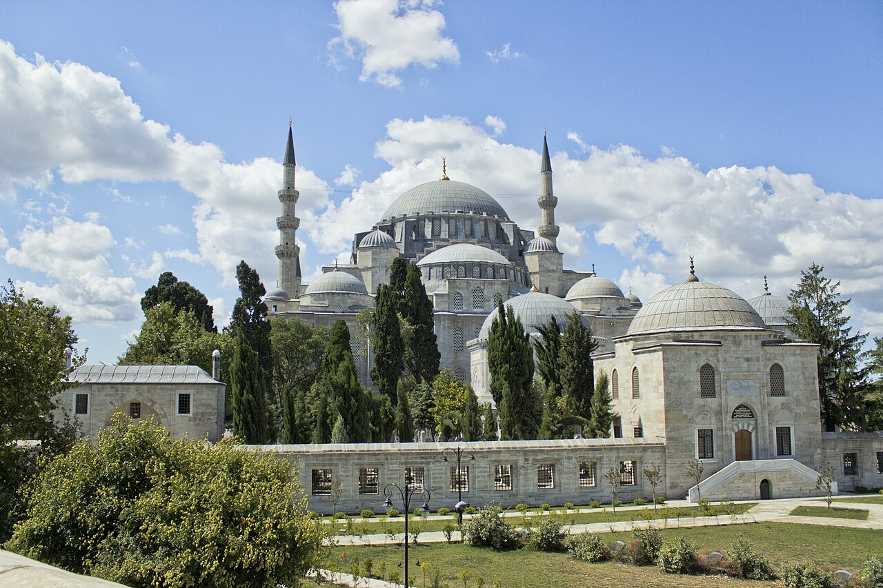
Domes, minarets and surrounding buildings of the Süleymaniye Mosque complex

1985 · Cultural heritage

Historic Areas of Istanbul

A cultural heritage property inscribed on the UNESCO World Heritage List in 1985.

Explore the province guide → Verify in the official record ↗
Photograph and rights

22 July 2013: the Süleymaniye component of the Historic Areas of Istanbul. The photograph shows this complex, not all four parts of the World Heritage property.

İhsan Deniz Kılıçoğlu / Wikimedia Commons · CC BY-SA 3.0 ↗

Wikimedia's version scaled to 1280 pixels wide; no additional cropping or retouching by us.

Image archive record ↗
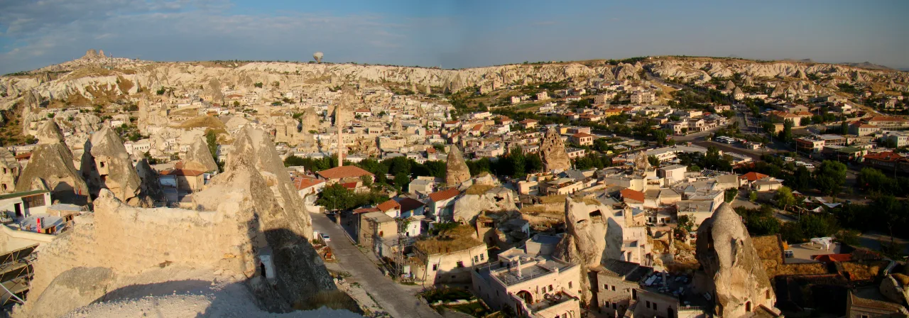
Göreme town, carved rock and housing seen from the southeast, 31 July 2009

1985 · Mixed heritage

Göreme National Park and the Rock Sites of Cappadocia

A mixed heritage property inscribed on the UNESCO World Heritage List in 1985.

Read the place guide → Verify in the official record ↗
Photograph and rights

Göreme town, carved rock and housing seen from the southeast, 31 July 2009

Uspn / Wikimedia Commons; değiştirilmedi / unmodified · CC BY-SA 3.0 — https://creativecommons.org/licenses/by-sa/3.0/

Image archive record ↗
Stone blocks and lion figures at Hattusa’s Lion Gate, 31 March 2016

1986 · Cultural heritage

Hattusha: the Hittite Capital

A cultural heritage property inscribed on the UNESCO World Heritage List in 1986.

Read the place guide → Verify in the official record ↗
Photograph and rights

Stone blocks and lion figures at Hattusa’s Lion Gate, 31 March 2016

Carole Raddato; Commons kırpması / existing Commons crop: Electragod77; ek değişiklik yok / no further changes · CC BY-SA 2.0 — https://creativecommons.org/licenses/by-sa/2.0/

Image archive record ↗
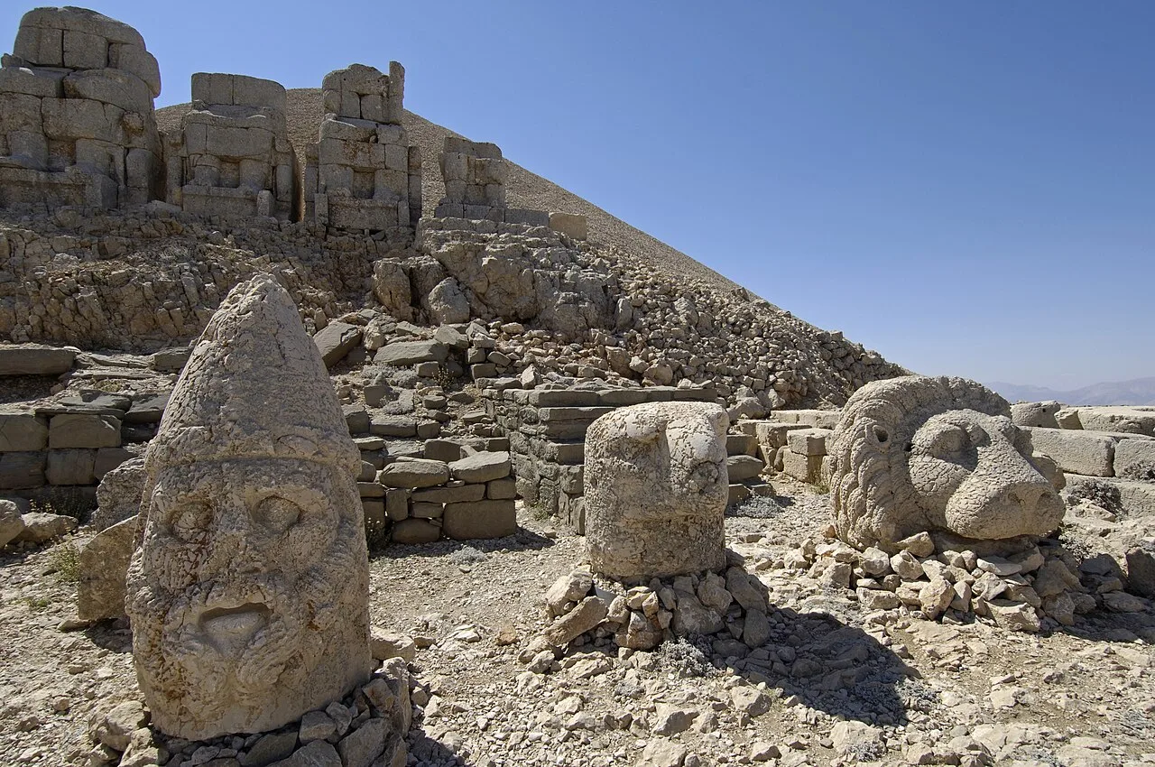
Sculptural heads, an eagle and a lion before stone statue bodies on Nemrut's east terrace

1987 · Cultural heritage

Nemrut Dağ

A cultural heritage property inscribed on the UNESCO World Heritage List in 1987.

Explore the province guide → Verify in the official record ↗
Photograph and rights

Nemrut's east terrace photographed by Dosseman on 12 September 2006. The dated image helps relate sculptural heads to statue bodies; it does not establish today's conservation arrangement or seasonal road access.

Dosseman / Wikimedia Commons; reduced-resolution Commons rendition · CC BY-SA 4.0 ↗

Image archive record ↗
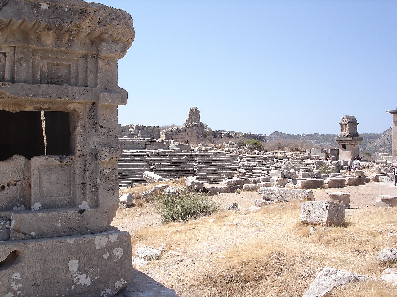
Lycian tombs and theatre remains at Xanthos

1988 · Cultural heritage

Xanthos-Letoon

A cultural heritage property inscribed on the UNESCO World Heritage List in 1988.

Explore the province guide → Verify in the official record ↗
Photograph and rights

2007: tombs and the theatre at Xanthos. This is the Xanthos part of the Xanthos–Letoon property; the sanctuary at Letoon is not shown.

E / IzmirEkmek · Wikimedia Commons · CC BY-SA 3.0 ↗

Wikimedia's version scaled to 1280 pixels wide; no additional cropping or retouching by us.

The source description and camera metadata differ on the day and month; the consistent year is used.

Image archive record ↗
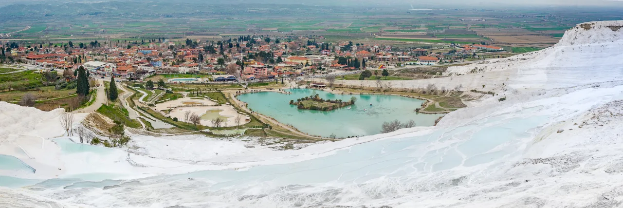
White travertine above the settlement at Pamukkale, 3 March 2013; not a record of present water levels

1988 · Mixed heritage

Hierapolis-Pamukkale

A mixed heritage property inscribed on the UNESCO World Heritage List in 1988.

Read the place guide → Verify in the official record ↗
Photograph and rights

White travertine above the settlement at Pamukkale, 3 March 2013; not a record of present water levels

Casal Partiu / Wikimedia Commons; değiştirilmedi / unmodified · CC BY-SA 2.0 — https://creativecommons.org/licenses/by-sa/2.0/

Image archive record ↗
Safranbolu’s historic houses and surrounding hills in a panorama photographed in 2006

1994 · Cultural heritage

City of Safranbolu

A cultural heritage property inscribed on the UNESCO World Heritage List in 1994.

Read the place guide → Verify in the official record ↗
Photograph and rights

Safranbolu’s historic houses and surrounding hills in a panorama photographed in 2006

Uğur Başak / Wikimedia Commons; özgün panorama, değiştirilmedi / original panorama, unmodified · CC BY-SA 4.0 — https://creativecommons.org/licenses/by-sa/4.0/

Image archive record ↗
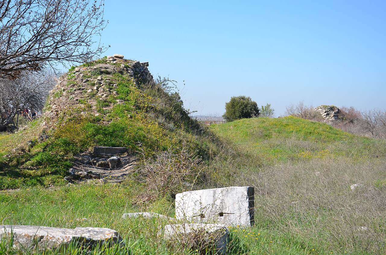
Stone-wall remains and spring vegetation at the archaeological site of Troy

1998 · Cultural heritage

Archaeological Site of Troy

A cultural heritage property inscribed on the UNESCO World Heritage List in 1998.

Explore the province guide → Verify in the official record ↗
Photograph and rights

15 March 2014: surviving remains at the archaeological site of Troy. This is a site photograph, not a reconstruction of the legendary war or a model of the Trojan Horse.

Laaaguita / Wikimedia Commons · CC BY-SA 4.0 ↗

Wikimedia's version scaled to 1280 pixels wide; no additional cropping or retouching by us.

Image archive record ↗
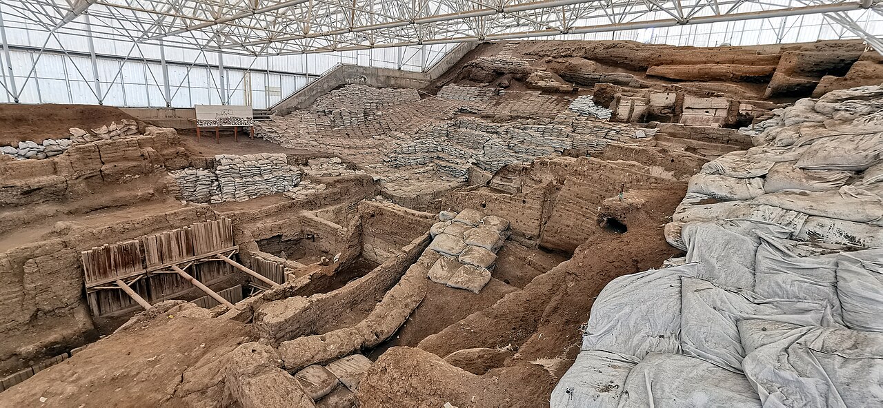
Excavated mudbrick-building remains beneath a protective shelter at Çatalhöyük

2012 · Cultural heritage

Neolithic Site of Çatalhöyük

A cultural heritage property inscribed on the UNESCO World Heritage List in 2012.

Explore the province guide → Verify in the official record ↗
Photograph and rights

27 November 2019: part of the excavated site at Çatalhöyük. The shelter and protective coverings are modern conservation measures, not the Neolithic settlement's original roof.

Murat Özsoy 1958 / Wikimedia Commons · CC BY-SA 4.0 ↗

Wikimedia's version scaled to 1280 pixels wide; no additional cropping or retouching by us.

Image archive record ↗
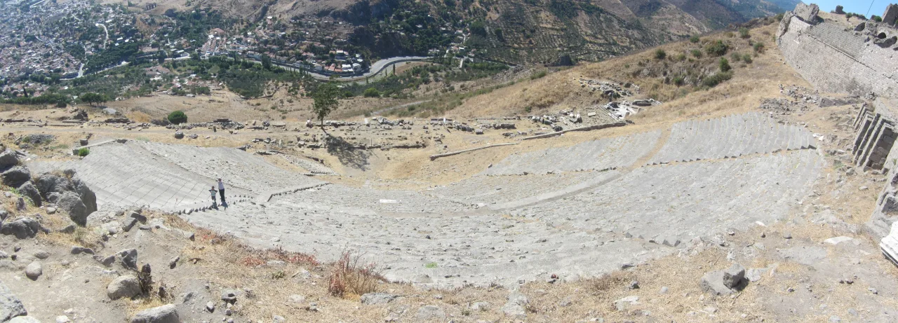
Steep seating of Pergamon’s theatre above Bergama, panorama photographed in 2011

2014 · Cultural heritage

Pergamon and its Multi-Layered Cultural Landscape

A cultural heritage property inscribed on the UNESCO World Heritage List in 2014.

Read the place guide → Verify in the official record ↗
Photograph and rights

Steep seating of Pergamon’s theatre above Bergama, panorama photographed in 2011

Tomisti / Wikimedia Commons; değiştirilmedi / unmodified · CC BY-SA 3.0 — https://creativecommons.org/licenses/by-sa/3.0/

Image archive record ↗
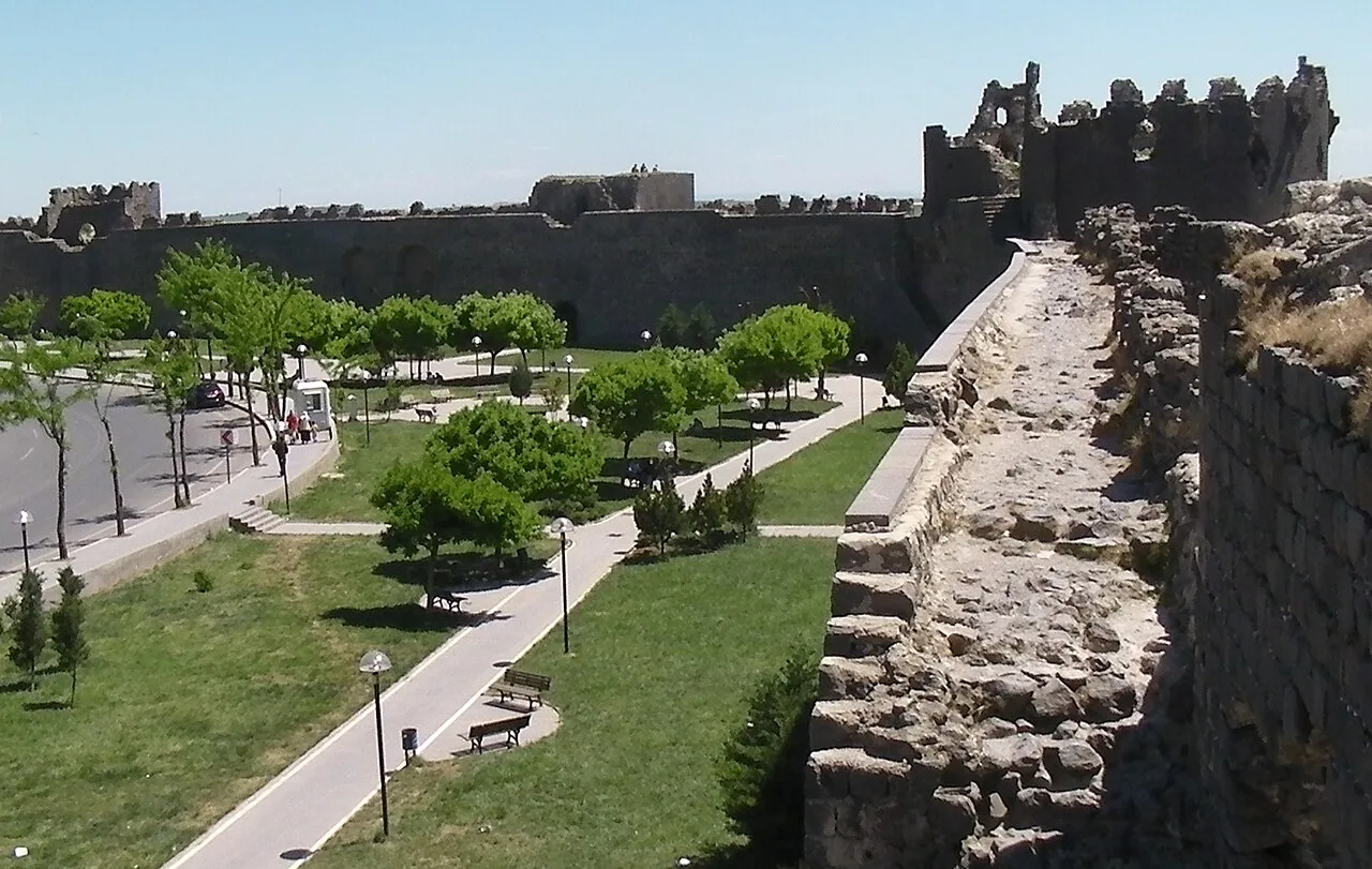
Walls, towers and a green space seen from inside Diyarbakır's fortifications

2015 · Cultural heritage

Diyarbakır Fortress and Hevsel Gardens Cultural Landscape

A cultural heritage property inscribed on the UNESCO World Heritage List in 2015.

Explore the province guide → Verify in the official record ↗
Photograph and rights

An interior view of the fortifications photographed by Brian Dell on 25 April 2010. This dated archive photograph does not establish present permission or safety for walking on the walls; use only open, authorised visiting routes.

Brian Dell / Wikimedia Commons; reduced-resolution Commons rendition · Public domain — released by the photographer ↗

Image archive record ↗
Ani Cathedral and the surrounding open plateau; an archive view from 2016.

2016 · Cultural heritage

Archaeological Site of Ani

A cultural heritage property inscribed on the UNESCO World Heritage List in 2016.

Read the place guide → Verify in the official record ↗
Photograph and rights

Ani Cathedral and the surrounding open plateau; an archive view from 2016.

Jaba1977 · Wikimedia Commons · Fotoğraf / photograph: 8 Mayıs / May 2016. Değiştirilmemiş kaynak görüntü / unmodified source image. · CC BY-SA 4.0 · https://creativecommons.org/licenses/by-sa/4.0/

Image archive record ↗
Stone walls and pillars in Building F at Göbeklitepe

2018 · Cultural heritage

Göbekli Tepe

A cultural heritage property inscribed on the UNESCO World Heritage List in 2018.

Explore the province guide → Verify in the official record ↗
Photograph and rights

Building F at Göbeklitepe, photographed by Dosseman on 22 September 2019. This is a dated view of a specific structure, not a view of the entire excavation or a statement about today's visitor route.

Dosseman / Wikimedia Commons; original published image · CC BY-SA 4.0 ↗

Image archive record ↗
Low walls and settlement layers in an exposed excavation area at Arslantepe Mound

2021 · Cultural heritage

Arslantepe Mound

A cultural heritage property inscribed on the UNESCO World Heritage List in 2021.

Explore the province guide → Verify in the official record ↗
Photograph and rights

Part of the Arslantepe excavation photographed by Zeynel Cebeci on 28 September 2018, before the 2021 UNESCO inscription and 2026 reopening. It does not show the full present protective roofing or visitor route.

Zeynel Cebeci / Wikimedia Commons; reduced-resolution Commons rendition · CC BY-SA 4.0 ↗

Image archive record ↗
Tumulus MM on the left and Tumulus P on the right at Gordion

2023 · Cultural heritage

Gordion

A cultural heritage property inscribed on the UNESCO World Heritage List in 2023.

Explore the province guide → Verify in the official record ↗
Photograph and rights

2 July 2019: Tumulus MM and Tumulus P within Gordion's burial landscape. This view shows this part of the property, not the entire excavated ancient city.

Archaeologist1950 / Wikimedia Commons · CC BY-SA 4.0 ↗

Wikimedia's version scaled to 1280 pixels wide; no additional cropping or retouching by us.

Image archive record ↗
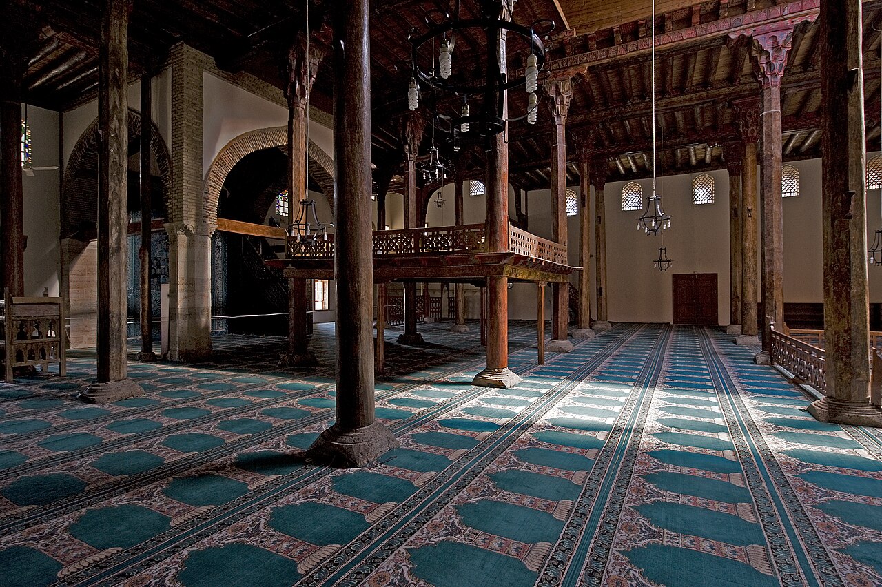
Wooden columns, ceiling beams and the muezzin's platform inside Eşrefoğlu Mosque in Beyşehir

2023 · Cultural heritage

Wooden Hypostyle Mosques of Medieval Anatolia

A cultural heritage property inscribed on the UNESCO World Heritage List in 2023.

Explore the province guide → Verify in the official record ↗
Photograph and rights

11 September 2008: the interior of Eşrefoğlu Mosque in Beyşehir. This is the Konya component of the five-part Wooden Hypostyle Mosques of Medieval Anatolia property.

Dosseman / Wikimedia Commons · CC BY-SA 4.0 ↗

Wikimedia's version scaled to 1280 pixels wide; no additional cropping or retouching by us.

Image archive record ↗
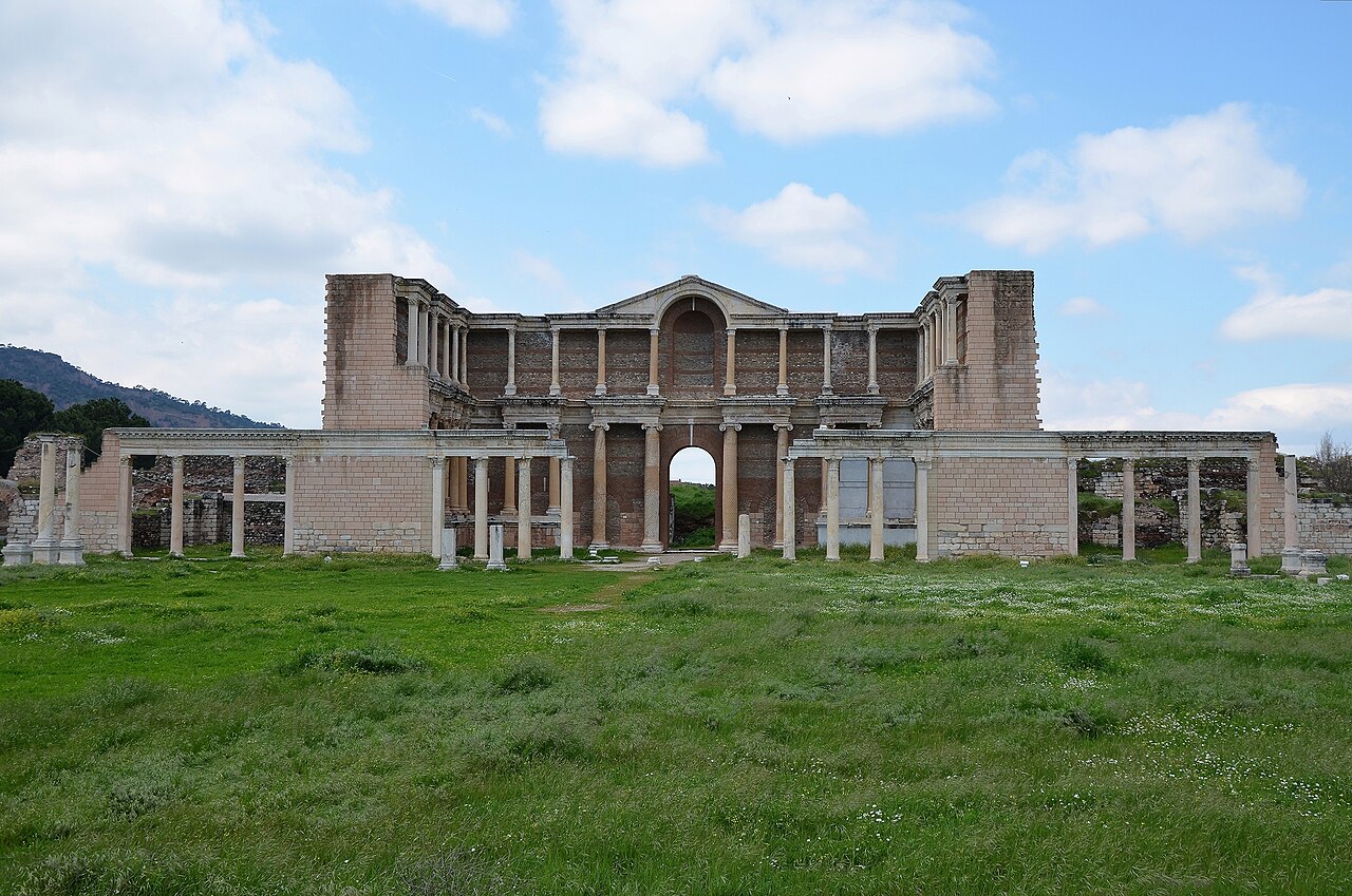
Restored monumental façade of the Roman bath-gymnasium complex at Sardis

2025 · Cultural heritage

Sardis and the Lydian Tumuli of Bin Tepe

A cultural heritage property inscribed on the UNESCO World Heritage List in 2025.

Explore the province guide → Verify in the official record ↗
Photograph and rights

2 April 2015: the bath-gymnasium complex at Sardis. This is the Sardis part of the Sardis and the Lydian Tumuli of Bin Tepe property; the burial mounds of Bin Tepe are not shown.

Carole Raddato / Following Hadrian · Wikimedia Commons · CC BY-SA 2.0 ↗

Wikimedia's version scaled to 1280 pixels wide; no additional cropping or retouching by us.

Image archive record ↗

Sources and scope

Plan your visit; check the source.

Province and region information is checked against Ministry of Interior records, visitor records against the Türkiye Culture Portal, and World Heritage information against UNESCO. Guides help you plan; confirm opening times and access conditions with the relevant institution before travelling. Photographs disclose their source, date and usage rights; videos made from AI regional illustrations are clearly distinguished from documentary photographs and footage.

Sources and official records3 sources