
Hoynat Island is in the coastal district of Perşembe; Perşembe Plateau is near Aybastı. Similar names should not lead you to plan them as one transport destination.
An AI-assisted synthesis of the sources below, with Atlas planning suggestions. This is not a first-hand visit report. Admission, transport and access conditions must be checked with operators before travel.
In this guide
See Hoynat as bird habitat
The rocks visible from shore provide habitat for seabirds. Sightings vary with season and conditions, so no encounter can be promised. Observe from permitted coastal viewpoints without feeding or disturbing birds.
Water drawing a route through grassland
The plateau’s meandering streams make sense within its gently sloping meadows. This is more than a scene to photograph from above: grazing, local life and sensitive ground are part of it. Keep vehicles off grassland.
Separate coast from altitude
Check road and weather conditions independently for the upland journey. Old festival dates or proposed heritage designations do not establish current arrangements. Choosing one focus for a short stay leaves more time to observe and return comfortably, rather than spending the visit travelling between similarly named places.
Establishing the scale of Altınordu
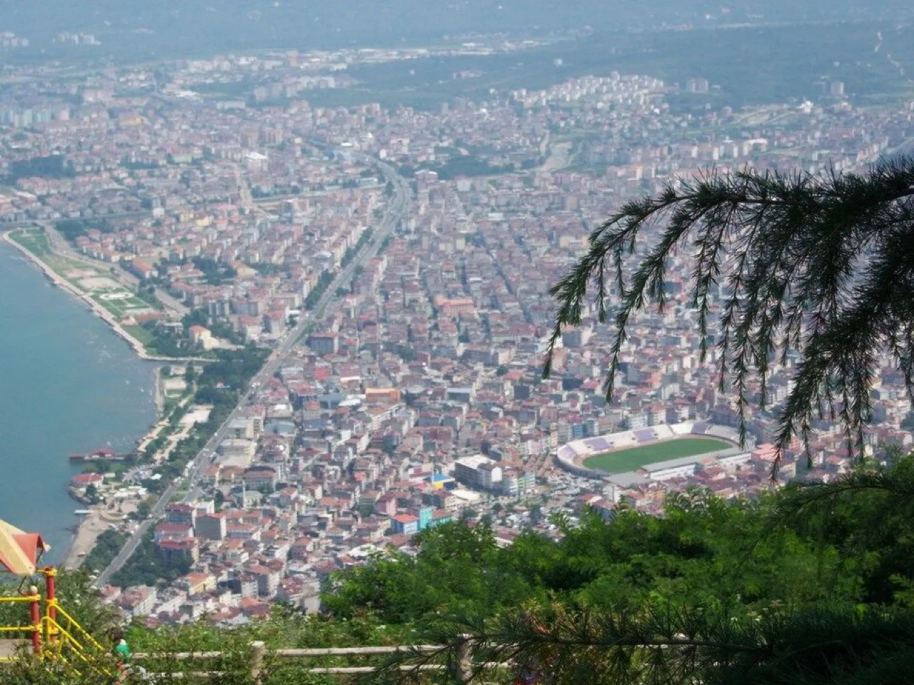
Altınordu, which contains Ordu’s urban centre, is a useful place to understand the relationship between the coast and higher viewpoints. At Boztepe, look beyond the photograph to the form of the settlement below. If using the cable car, verify that day’s operating, weather and access arrangements; the existence of a named viewpoint does not guarantee continuous transport.
Paşaoğlu Mansion and its ethnographic collection provide an opportunity to examine domestic organisation and local material culture. Leave time between a museum, walking and a meal rather than treating the city solely as an overnight base for upland excursions. A coastal section that looks relatively level and a hillside route with stairs do not have identical accessibility. Choose a shorter section suited to the actual visitor’s requirements and ask operators about the particular entrance being used.
Reading the coast through Ünye, Fatsa and Perşembe
Ünye’s Kadılar Yokuşu and living cultural heritage museum offer a focus on the architecture of a coastal town. Bolaman near Fatsa and Yason Cape towards Perşembe provide different stops along the same broad coast. Instead of grouping everything under “sea views”, compare a mansion, a townscape and a religious building.
The church at Yason belongs to the nineteenth-century heritage of Greek Orthodox communities who lived in the area. Official publications give its construction year inconsistently as 1868 and 1869, so this guide identifies the period rather than pretending the discrepancy does not exist. The Argonaut story is a separate mythological layer: association of a legend with a place does not establish archaeological proof of the event. Viewing Hoynat does not require approaching protected bird habitat or landing on the island; observation from the coast can be the more considerate choice.
Two places called Perşembe, and several inland decisions
The district of Perşembe is coastal; Perşembe Highland and its meanders are in Aybastı. Write the distinction into map searches and bookings. Çambaşı lies in another upland area towards Kabadüz, while Ulugöl is in Gölköy and Gaga Lake is in Fatsa. These names should not be interpreted as one compact circuit of adjacent lakes and pastures.
With limited time, separate a coastal day from one inland day. At Aybastı, the meanders are more than a photographic outline: consider water, land use and the everyday rhythm of an upland settlement together. Around Çambaşı, a nature visit and a winter sports programme demand different preparation. Do not assume vehicle access will be straightforward in snow or fog. Establish current roads and the selected activity’s operating conditions before committing to the journey.
Understanding hazelnuts, regional plants and shopping
Hazelnuts and related products connect Ordu’s agriculture with souvenir shopping. Asking about the producer, processing and ingredients is more informative than choosing the largest packet. Small quantities of different products allow useful comparison. Orchards remain production spaces, not unauthorised harvest experiences or unrestricted photographic locations.
Ingredients locally called sakarca, mellocan and galdirik, together with collard dishes and maize bread, open another layer of regional food. Ask which part of a plant is used and how it is prepared, but do not forage or eat wild plants using this guide as identification advice. A coastal programme can incorporate pide or available fresh fish; an inland day also needs realistic accommodation and rest decisions. Ask the business about the present menu, allergens and seasonal supply rather than assuming every speciality is offered every day.
Choose the visit that fits your question
Correct location
Distinguish Perşembe district from Perşembe Plateau.
Bird observation
Watch quietly and from a distance.
Upland reading
Connect meanders with meadow use.
Visual exploration before you travel
I am Ordu
A promotional view of the province’s coast and interior, not a one-day itinerary or current facilities list.
Kültür ve Turizm Bakanlığı WebTV · Watch the official publication ↗
Practical questions before your visit
Is Perşembe Highland in the coastal district of Perşembe?
No. The coastal district and Perşembe Highland in Aybastı are different places. Yason and Hoynat belong to a coastal programme, while the upland meanders require an inland route decision.
How should myth and history be separated at Yason?
The Argonauts and Golden Fleece belong to mythology. The visible church belongs to nineteenth-century Greek Orthodox community heritage. Since official sources disagree on the precise construction year, identifying the period is more defensible than presenting disputed precision.
Should every highland destination be added to a two-day stay?
No. A day for the city and coast, followed by one inland branch such as Aybastı or Kabadüz, creates a clearer programme. Do not combine Gölköy, Fatsa and highland approaches merely because the names appear on one list.
Sources and scope of this guide
These primary sources support the historical and heritage background. Comparisons and suggested ways to organise a visit are Atlas editorial analysis, not instructions from the source institutions.
- Kültür Portalı · Hoynat Adası ↗
- Kültür Portalı · PERŞEMBE YAYLASI ↗
- Ordu İl Kültür ve Turizm Müdürlüğü — Doğal alanların ilçe dağılımı ↗
- Ordu İl Kültür ve Turizm Müdürlüğü — Yason Burnu ↗
- Ordu İl Kültür ve Turizm Müdürlüğü — Ünye, Perşembe ve Altınordu kültür rotası ↗
- Ordu İl Kültür ve Turizm Müdürlüğü — Yöresel yemek ve ürünler ↗
- Kültür ve Turizm Bakanlığı WebTV — Ben Orduyum ↗